
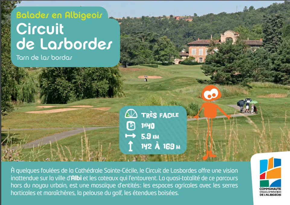
A few strides from Sainte-Cécile Cathedral, the Circuit de Lasbordes offers an unexpected view of the city of Albi and the surrounding hillsides. 5km900/1h40
Route details
Description
Almost all of this course outside the urban core is a mosaic of entities: agricultural areas with horticultural and market garden greenhouses, the golf course, wooded areas.
The agricultural plain
In the Middle Ages, the western districts of Albi had a predominantly agricultural vocation. Large estates belong to the bishopric or to wealthy notables whose names will give rise to the urban entities of the 1989th century (Fonlabour, Canavières, etc.). In the XNUMXth century, pastel and hemp were grown in Canavières and Les Fargues. In the XNUMXth century, two types of agriculture were maintained in these districts: “open field” agriculture in the western part (La Janade, etc.) and market gardening and nursery agriculture on the upper and lower Canavières sites. From XNUMX, leisure activities develop
with the creation of the Lasbordes golf course. On almost the entire route, you keep a view of the Tarn and the city, dominated by the Cathedral of Sainte-Cécile and the Palais de la Berbie. This rural setting, close to the city center, surprises and delights the eye of the walker.
The buildings you may encounter are typical of agricultural activity
long dominant in this sector. The trusses are built from
of a set of pebbles and bricks. The lower part of the walls is traditionally made up of pebbles in a vertical or oblique arrangement, the upper part is made up of a mixture of pebbles and bricks.
From the Chemin de Canavières, observe the farm on your right (Chemin des Peupliers). In the middle of a market gardening area, this farm in good
state, dating from the end of the XNUMXth century, is made up of two wings and a central building. One wing houses the dwelling, the rest must have been for agricultural use. It is a built ensemble typical of the region. In the middle of the agricultural plots, several
wells were built during the 4th century. With a floor area of approximately 2 mXNUMX, they are made up of three solid walls, the fourth being wide open to allow access to water. The whole supports a tiled roof with a single
backward slope.