


In the heart of the Tarn Valley.
Along this heritage trail, discover the Ambialet peninsula, its churches, its village and its Priory.
Along this heritage trail, discover the Ambialet peninsula, its churches, its village and its Priory.
Route details
Alert
Description
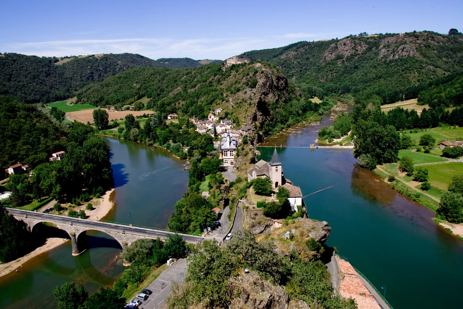
Around a schistous needle, the Tarn makes a long loop of 3 km. When the river seems to retrace its steps, the Ambialet peninsula is only about thirty meters wide.
This unique site, which was for more than two centuries the most important stronghold of the Albigensian region, still bears traces of a prestigious past.
This circuit will make you discover the different monuments and remains of Ambialet. From the old monastery, at the top of the promontory, you will have a spectacular view of the isthmus.
Departing from the heart of the village near the fountain, you take the narrow streets up towards the start of the Stations of the Cross. While following the signs, you will arrive at an alley made up of steps, then in front of you will be a cross which marks the start of the path on shale rock. Climbing this path on rock takes around twenty minutes depending on the pace. It will take you to the priory as well as the esplanade at the foot of the Notre Dame de l'Auder church with its breathtaking view of the valley. Don't miss the view from the rock by going around the church on the right, go behind the cemetery to admire the view.
Retrace your steps, walk alongside the priory to continue the walk. Facing the car park and the entrance to the priory, to the left of the road the path goes into the woods. You will eventually rejoin the road, and go down along this road then until you pass the hamlet at the bottom of the hill. The rest of the walk takes you to the village of Ambialet along the Tarn river on the road, note that this part is in full sun.