

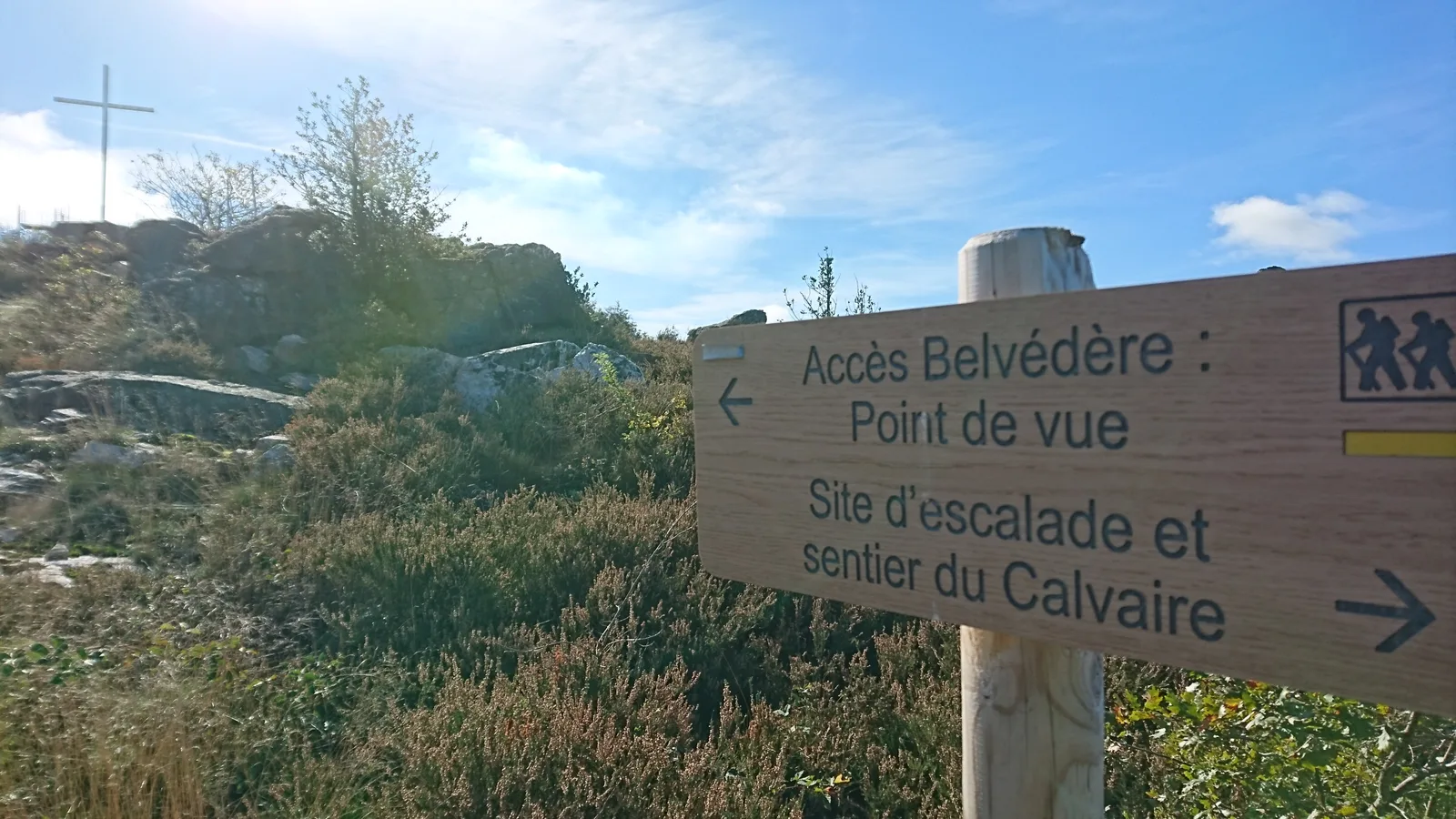
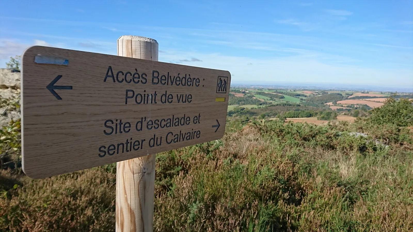
Sentier du Calvaire
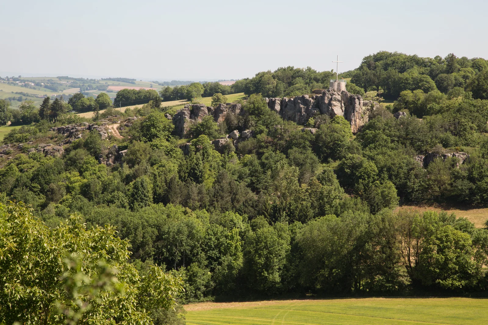
The name of the commune of Mont-Roc was chosen in 1926 because the rock and the rocks characterize the country. Before this date, the village was called “Montcouyoul”: the mountain of cuckoos.
Route details
Description
Mont-Roc is located in a triangle formed by the meeting of the Dadou, one of the most important tributaries of the Agout, and the Dadounet. Roc du Calvaire, Roc de la Loubière, Roc de Bermenat, Roc de Biais, Roc du Cayla, Roc du Suquet, Roc du Castelas, Roc des Pauquets, all these names are often linked to castles, some ruins bear witness to their presence.
Le Calvaire is particularly known to climbers because the climbing site since its reopening in 2016 is again frequented throughout the year thanks to an exceptional exposure, sheltered from the autan wind and the departures are shaded. Appropriate equipment is necessary for the practice of climbing, respecting the internal regulations in place.
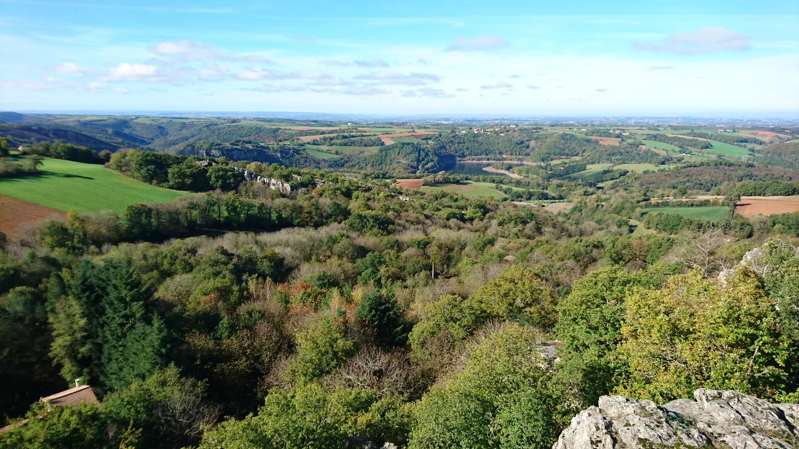
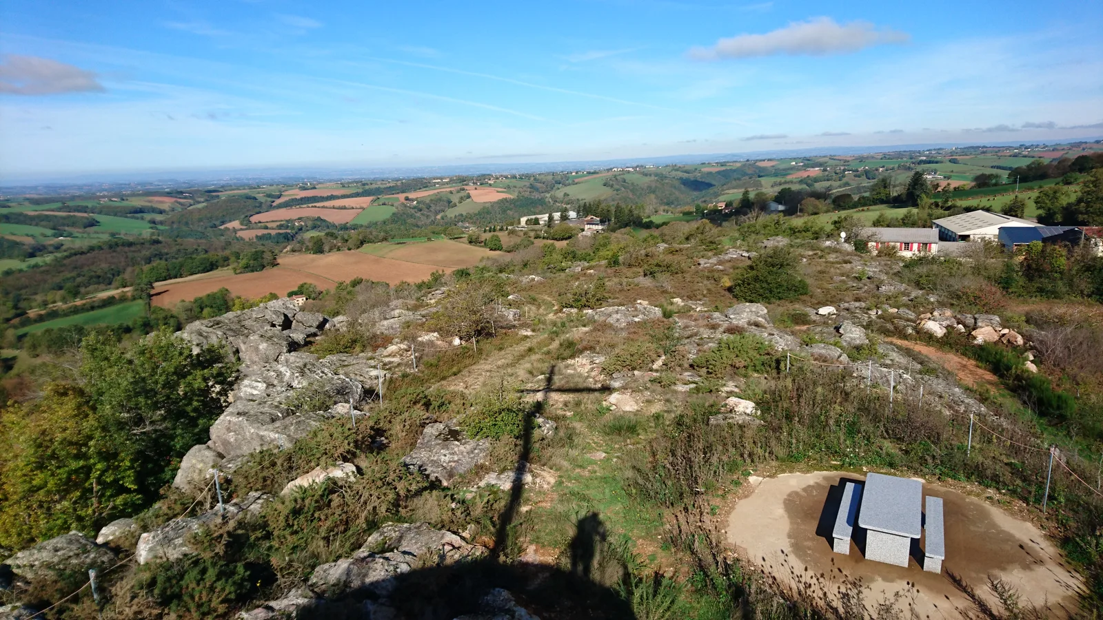
During this development, a path was opened allowing access to the secure Belvedere and making a family walk. The Belvedere constituting the highest point will offer you a panoramic view of part of the Razisse lake and the Department.
Le Calvaire is particularly known to climbers because the climbing site since its reopening in 2016 is again frequented throughout the year thanks to an exceptional exposure, sheltered from the autan wind and the departures are shaded. Appropriate equipment is necessary for the practice of climbing, respecting the internal regulations in place.
During this development, a path was opened allowing access to the secure Belvedere and making a family walk. The Belvedere constituting the highest point will offer you a panoramic view of part of the Razisse lake and the Department.